
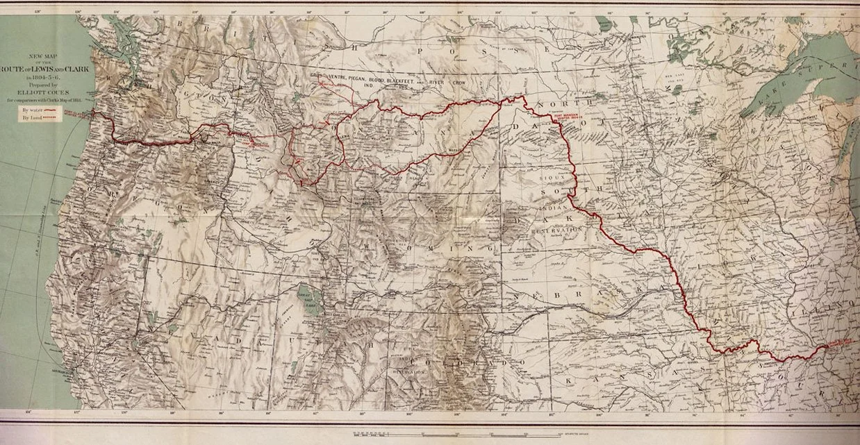
“New Map of the Route of Lewis and Clark in 1804-5-6, Prepared by Elliott Coues, for comparison with Clark’s Map of 1814.” Taken from the four volume History of the Expedition under the command of Lewis and Clark by Elliott Coues, published in 1893. This is one of three fold-out maps contained in a pocket inside the back cover of volume four; it measures 15 inches tall by 31 inches wide. It was printed in New York by Julius Bien & Co., best remembered today for his lithographed edition of John James Audubon’s The Birds of America, produced in the 1850s.
The expedition route, shown with the red line, began in present day Illinois, just outside St. Louis, Missouri (shown lower right), on May 14, 1804. The route extended west to the Pacific Ocean, where the party established Fort Clatsop in present day Astoria, Oregon (shown upper left). They remained here during the winter of 1805-06 before beginning the return journey, which ended in St. Louis on September 23, 1806.
Commissioned by President Thomas Jefferson as part of the 1803 Louisiana Purchase, the Corps of Discovery, led by Captain Meriwether Lewis and Second Lieutenant William Clark, comprised 37 soldiers and officers of the U.S. Army, and three civilians. The primary mission was to establish an American presence in the newly acquired lands, but secondary outcomes included the gathering of important scientific information and the establishment of relations with numerous Native American tribes, whose assistance proved critical to the success of the journey.